• Welcome to the Two Wheeled Texans community! Feel free to hang out and lurk as long as you like. However, we would like to encourage you to register so that you can join the community and use the numerous features on the site. After registering, don't forget to post up an introduction!

A 2 week ride to a country 10 million years old

What a ride!

Thanks, we had fun for most of the ride and memories for all of it. Second week coming up. I've shown you joy, sadness and beauty. Devastation along with Utah highway 95 (Natural Bridges) and Co. highway 145 to Ouray coming up next. More joy, sadness and beauty also coming up later. I just lost 2 hours of typing and picture copying.
 
Maurice wondering who planned this trip.
35315328145_99e31c5d2a_b.jpg

He must be quite the talented rider to handle that bike with no hands. :trust:
 
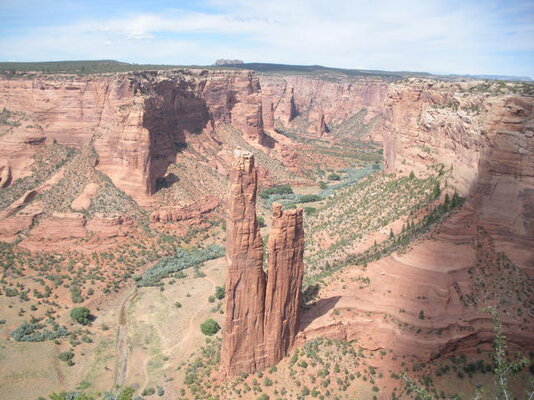
Texas T, it's no wonder that our pictures look so similar. When you tell me to go somewhere, I usually try to comply. I haven't been disappointed yet. Canyon de Chelly is a case in point. You did notice that the Canyon is deeper in my picture? Yep, in 7 years it got 0.07 inches deeper. That's a little more than two hairs diameters.
 
Last edited:
Day 8
Our original plan was to meet the rest of the Yahoos in Moab the day after tomorrow, but we decide we had plenty of time to go to Ouray since we were a day ahead of schedule because of the closure of the river in Zion and the decreased hiking. We head south from Hanksville to Natural Bridges NM.

Typical scenery along Hwy 28 and 95. The latter has red rock cliffs bordering the highway for nearly the entire distance from Hanksville to Natural Bridges NM.
34928127750_7be78a7470_b.jpg


35275659296_006b5af1e9_b.jpg

35315805845_4d9320cb44_b.jpg
[/url]


An Iconic picture of the highway 95 bridge over the Colorado River, framed by red towers. This is also the beginning of Lake Powell, which extends all the way down to Page Arizona. The lake is nearly 200 miles long and nearly 600 feet deep.
34472455944_b722937491_b.jpg


Superman Maurice holding up Owachomo bridge. Difference between a bridge and an arch? A bridge is formed by flowing water along a creek or river. An arch is formed by erosion caused by wind, rain, freezing ice etc.
34505562753_e16745917a_b.jpg


A young ranger lady took this picture. She was on vacation at the monument.
35275757916_6262d5ed8c_b.jpg


We met this guy and his buddy, both from Australia, at a convenience store. They bought 2 bikes off Craigslist and are riding them from Arizona to Canada and back. They’re on a one of those “ride abouts” for as long as it takes.
35185907771_5551305fb2_b.jpg
[/url]222937[/ATTACH]
 
Up next. Plans go awry. A little bit of Colorado. More snow.
 
Day 9
We spent the night along a Forest service road before going to Natural Bridges, so day 9 actually started with Superman Maurice holding up Owachomo Bridge and day 8 was a lot of riding. After Natural Bridges, we headed to Ouray.
Along 145 south of Telluride.
35315909205_ec89d0c722_b.jpg


I stopped here because I liked what the clouds and mountains were doing to each other. I’m actually blocking someone’s driveway. They have a sign for no entry and that we were in their scope cross hairs. Ray pointed out later that they should have someone come by and remove the UPS delivery notes as there were about 10 to 12 of them. Maybe the sign would be more believable.
34472553574_9ee1c3f7f8_b.jpg


Last of the pictures on day 9. We got a 911 text from Fast F3. Disaster had struck. The three of us would continue our ride without the other three riders joining us. Nothing we saw on the way to Ouray seemed worthy of pictures. We did meet up with two of them in Ouray and saw them again in Grand Junction.

Day 10
We decided to ride to Grand Junction to visit Bobby in the hospital and then decide what to do for the next 5 days.

Again, not a lot of stopping. I think we stopped to delay the meeting with Bobby rather than to enjoy the scenery.
The old flume alongside the Delores river.
34472598444_0f1d1a89ca_b.jpg


Along my favorite road in Colorado, 141 from Naturita to Grand Junction.
35316014245_719d9d9cf0_b.jpg


I saw this sign beside the highway. Lots of Harley parts piled around the base. Headlight and fairing made it recognizable as a Harley. I turned around and took a picture because I was riding with C. Ray (Charles Ray Holder).
35149087682_9aed2429b6_b.jpg


Bobby was in intensive care and they would only let one of us go in at a time and the first one was me. Bobby was in good spirits, but in a lot of pain. Bobby explained that he was riding alone when he fell, due to each of them stopping to take pictures and also different riding abilities. Phil was ahead and Mark was behind. Neither saw the accident. During our brief visit I asked him if he needed us to do anything for him and he told me his wife was in route from the airport and Phil and Mark had taken care of his bike and gear. He encouraged us to continue our trip and keep him in our prayers. He also requested that Maurice and Ray not come in so that he could give himself some morphine and go to sleep. After a brief discussion with my friends, we decided to do exactly as Bobby requested. We went to Colorado National Monument just outside Grand Junction. Phil and Mark decided to take a couple of days to pick up camping gear, trailers, etc and head back to Texas.

There are some steep cliffs in Co. NM.
35149115492_122336acf4_b.jpg


Scenery similar to Canyon de Chelly.
35316076105_aedfcf768b_b.jpg


The road in the park is great.
35316100485_48b00eb8a0_b.jpg


We spent the night in the Colorado National Monument campground. The rules:
No more than 7 people per campsite
No more than 3 tents per campsite
OK so far.
No more than 2 vehicles per campsite.
A 40 foot motorhome towing a car was OK, but the camp host told us 3 motorcycles was not. We paid for two campsites and used one. I parked my motorcycle in the second one. We went to Fruita for dinner and when we returned there was a small motorhome in our second site. The camp host had rented out the site to another camper. My pay tag had been removed from the spring clip, signifying that the site was available so, the driver of the camper parked and walked back to the pay station where the camp host told him to fill out a form and deposit it, along with full payment, into the lock box. I parked my bike behind his camper. I guess you get what you pay for with volunteers.
 
Day 11
The second half of highway 128 from Cisco to Moab is a joyous road. It follows the Colorado River at the bottom of a red rock canyon. Fifty miles of this. It's going to be hard to take.
34472715364_5a4c40ed22_b.jpg


Maurice pointed out this dinosaur rock.
35275990406_53cbe07a03_b.jpg


We ate lunch at a restaurant in Moab. We all thought it was good. I notice a chicken fried steak on the dinner menu for less than $10. Other items similarly priced.


Dead Horse Point outside of Moab. That's Potash Road down in the canyon. It ties into the White Rim Trail at the top of the picture.
34472751414_958dbf97bb_b.jpg


Grand View in Canyonlands NP. Grand View is the actual name of the point. The White Rim Trail is somewhere down in that maze. Makes one want to be mounted on dual sport bikes.
35276022886_b56b06d51c_b.jpg


Mesa Arch The second picture is taken from about the point the red shirted little boy is standing in the first picture.
35186175851_ffd8bbbd0a_b.jpg


35316208905_7799ed3eee_b.jpg


Balanced rock in Arches.
34472838484_5b0e1e51ec_b.jpg


Dinner time. “You guys want to eat at the same place we had lunch?”
“No.”
“No.”
It wasn’t until later that I realized that our inexpensive diner didn’t sell beer. We rode through Moab to Monticello where we decided to spend another night in a motel. I believe smell had something to do with our decision. We ate in a small restaurant across from the motel. Ray and Mo each had chicken fried steaks. The best description of their meal would be: TV Dinner. They cost $15.95 each. The irony? Our restaurant was the only one open in town and it didn’t sell beer.
 
Your trip pictures and narrative continue to keep me engrossed. I especially love the picture of the I-95 bridge. I wish that were my picture. Great shot!

As for the campground host, they tend to run the gamut. At the high end was Chuck Silas, who hosted outside of Creede for years, and once volunteered to drive 50 miles to pick up a trailer tire to replace my blown out one. At the low end was an old geezer near Crested Butte whose generator, which he ran from 7am to 11pm, sounded like a lawn mower engine. If anybody complained, he would rev it over & over like a drunken Harley rider, just to let the campers know who was boss in the campground. Most of the ones I've met are very tolerant of things like 3 motorcycles, as long as everybody is quiet and plays by the rules. Unfortunately, you hit the exception..... :thpt:
 
Texas T, it's no wonder that our pictures look so similar. When you tell me to go somewhere, I usually try to comply. I haven't been disappointed yet. Canyon de Chelly is a case in point. You did notice that the Canyon is deeper in my picture? Yep, in 7 years it got 0.07 inches deeper. That's a little more than two hairs diameters.
:rofl:


I count at least six more photos that I have duplicates of from the same spot but I won't bore everyone with posting them. The day we rode down the hill to the bridge over the Colorado River / Lake Powell it must have been 100° or more and the tar snakes were incredibly treacherous. We were probably doing under 35 mph for most of that last stretch. Your photo indicates that they must have repaved that section in the past seven years.

Your ride report is wonderful.
 
Last edited:
That bridge picture is easy on a bike. There are no shoulders, but there is enough room for a bike without getting hit by passing traffic.
 
Nothing we saw on the way to Ouray seemed worthy of pictures.

:tab :lol2: Right.... ;-)

Bobby was in intensive care and they would only let one of us go in at a time and the first one was me. Bobby was in good spirits, but in a lot of pain.

:tab So how is he doing now? Is he still in the hospital up there or is he back home? Any word on the extent of his injuries? Any specific prayer requests for him?

:tab It is kind of funny how we all end up with the same pictures from these trips. I try to keep that in mind when deciding what pics I want to take on a trip, but dang, there are shots you just HAVE to take! And by the way, the White Rim road is an amazing ride if you have not done it yet, but do it on a 650 or smaller DS and run it counter clockwise.
 
:tab :lol2: Right.... ;-)


:tab So how is he doing now? Is he still in the hospital up there or is he back home? Any word on the extent of his injuries? Any specific prayer requests for him?

:tab It is kind of funny how we all end up with the same pictures from these trips. I try to keep that in mind when deciding what pics I want to take on a trip, but dang, there are shots you just HAVE to take! And by the way, the White Rim road is an amazing ride if you have not done it yet, but do it on a 650 or smaller DS and run it counter clockwise.


Bobby is in Denver. Rehab. Broken back. Another surgery coming up to release pressure on his spine. He seems to be in good spirits. Anybody have a design for a wheelchair sidecar that allows the sidecar passenger to be the driver? Prayers really appreciated.
 
Any danger of paralysis or too soon to know?
 
About the belly button down. T11. Right now it seems doubtful he will have any feeling at all.
 
Last edited:
Day 12

Just before going down Moki Dugway, there is a dirt road going to Mulie Point. It’s about 5 or 6 miles long. The end of the road overlooks Goosenecks State Park, which makes the ride well worth it. Although, I did hear it described as, “Just another deep hole at the end of a long *** bumpy road.” You decide. There is a much better view, but it requires a hike and we are through hiking for this trip.
34472863844_ef3be9340f_b.jpg


Moki Dugway. Way over rated as a difficult road. Note motorhome.
35316287025_00855f8fd9_b.jpg


Mexican Hat, the formation and the town are at the bottom of the Dugway.
34928618970_65a6786c86_b.jpg


Valley of the Gods, aptly called the miniature Monument Valley.
34928662280_7560ea6ef7_b.jpg


One of three Chinese girls that were touring the southwest. They were on summer break from some school in Boston. Two wanted to have their picture taken sitting on my bike. None wanted a ride.
34928703080_7da21a47b3_b.jpg


We split up in Mexican Hat, with Ray and Maurice going back to Taos to drop off luggage before getting a motel with a hot tub. They will ride back tomorrow. I went to Pagosa Springs where the cheapest campsite was $25. No thanks, I spent the night down a national forest access road just west of Wolf Creek Pass. Free. Did I mention I’m cheap?

Day 13
A little waterfall not far from Wolf Creek.
35186339321_fbdc19bbce_b.jpg


Highway 149 headed N toward Lake City.
35186363651_e9a7fede43_b.jpg


I rode the dirt road that parallels 149 and Clear Creak to this waterfall. The North Clear Creek Campground was closed.
34928754840_9a47154844_b.jpg


149 is a beautiful ride, especially early in the year.
35276259436_4bafda559f_b.jpg


I ate lunch in Lake City and headed back to Taos to spend the night with my brother and his wife. I couldn’t drive past the gorge bridge without stopping.
35149472962_0061a29cb0_b.jpg


I’m tired. I think I’m gonna go home.
34506061743_3bae08287e_b.jpg


About 3,400 miles on the FZ1. New tires waiting when I get back to Bryan. On the drive back, I found Story Lake to be as full as I have seen it in 15+ years.
35276289536_d582a20332_b.jpg
 
About 3 years ago, I told my 4 primary riding buddies that I wanted to be told when they were tired of me tagging along and slowing them up. We've been riding together for more than 25 years, but you see, I'm 20 or more years older than they are. All they had to do was tell me, "It's time." Well, I never dreamed that it would be me making the decision, but I did on this trip. We've grown apart in what we can and want to do. I drink less than a case of beer a year and most of that is when a group of friends meet for our monthly beer meeting. Some of the riding buddies on this trip are included in the monthly meetings. We had dinner one night on this trip and the food portion of our bill was $32.95. The total bill was $90, including tip. I drank water. I don't want to decide where I eat dinner by watching for beer signs.

One can see a lot by driving down the highways of America, but get off the road and the scenery gets better and it becomes possible to take pictures without strangers being a part of the scene. I want to hike. I'm GOING to hike. Hiking is the "H" word to my buddies.

At this point, I have planned my last long trip with the group. A long weekend ride would be OK. If one of them planned a longer trip, I might join, but I think I see a lot of solo rides or rides with couples in my future. Well, not a lot. I am past 69 years old.
 
:tab Finding good riding buddies is priceless. Over the years, the riding buddies have changed now and then, but I have really appreciated the time spent with all of them. I am lucky to have a few right now that I really enjoy doing trips with because we just seem to mesh well in terms of expectations, abilities, attitudes, riding styles, etc,... My biggest problem now is finding the time to ride with them more often than once or twice a year. We've made some great memories over the years though!

:tab Time spent riding alone is also priceless. That freedom to change things on a whim means a lot. The solitude to just be alone and take it all in is great. I'd totally be into hiking. My knees aren't as wild about it though :-P I can't afford knee work and don't have insurance, so I have to really limit the amount of off the bike walking I can do. Stairs in particular kill me in a very short time. Interestingly, riding the bikes, even off road, don't bother my knees beyond just general stiffness and soreness.

:tab I really hate to hear that about Bobby. I mentioned him to the kids this evening before they went to bed. They will make sure we don't forget to pray for him and his family. They've been praying for Zac for years and look how far he's come since his accident!
 
:tab Finding good riding buddies is priceless.

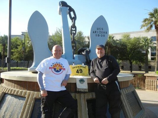
Mike was my best riding partner ever. I was so sad when he got transferred to FL. Our wives got along GREAT which is a huge component to a successful week long ride.
 

Attachments

  • Mike Boyd and I at the Arizona memorial - smaller.jpg
    Mike Boyd and I at the Arizona memorial - smaller.jpg
    49.3 KB · Views: 282
Thanks for making the time to write and copy pix and post.

I appreciate the details you point out in the pics; the horses, the names of roads-- it makes it even more real. AND, great for planning purposes.

Speaking of planning, which month do you think is best for a Utah moto, hiking and camping trip?

Also appreciate the honest reappraisal of riding buddies.

Thanks again,

This trip took place the latter half of May. We chose May because school was still in session and maybe it wouldn't be crowded. I think lots of others had the same idea. We saw 28 degrees and 96 degrees. I've been there in the later part of June and was glad my wife and I could zip our sleeping bags together at Bryce campground. My choice for hiking would be May and October. For motorcycle riding add June and September. Expect extremes in weather any month.
 
Back
Top