• Welcome to the Two Wheeled Texans community! Feel free to hang out and lurk as long as you like. However, we would like to encourage you to register so that you can join the community and use the numerous features on the site. After registering, don't forget to post up an introduction!

Big Bend after Christmas

A special shout out to Joshua for saving the day on Old Ore Road when my chain broke the master link and he had a spare 520 repair kit.
Thank you ��
 
Dang Mark , how did it break ? Did something get wedged in between the chain and the sprocket ?
 
Last edited:
Outstanding! Incredible aerial view of the vast Big Bend wilderness and those little, tiny bike riders.
 
Great video. Where is that spot

Sent from my SAMSUNG-SM-G870A using Tapatalk
 
Great video. Where is that spot

Sent from my SAMSUNG-SM-G870A using Tapatalk

Its called "On Top of the World" and I don't have the coordinates. Its in the Big Bend area. East of the State park, north of Terlingua. I need to get the coordinates some day.
 
[ame="https://www.youtube.com/watch?v=kGZ93GgXB1g"]On Top of the World v2.0 - YouTube[/ame]
 
A short video from On Top of the World. This is v2.0 and high rez.

https://youtu.be/kGZ93GgXB1g

Well, please somebody embed this.

YouTube, being owned by Google, feels the need to constantly change how their links work. That makes it hard to keep up with the changes for embedding. Anyway, if you grab the link from your browser address bar instead of using the "Share" option, you get this,

Code:
https://www.youtube.com/watch?v=kGZ93GgXB1g&feature=youtu.be

You have to cut the "&feature=youtu.be" part off the end of the link. If you do that, you get the video embedded just as it looks in my post above.

[edit] I just figured out how to change the embed routine to make it work with the link you used! :thumb:

[ame="https://youtu.be/kGZ93GgXB1g"]On Top of the World v2.0 - YouTube[/ame]
 
Its called "On Top of the World" and I don't have the coordinates. Its in the Big Bend area. East of the State park, north of Terlingua. I need to get the coordinates some day.
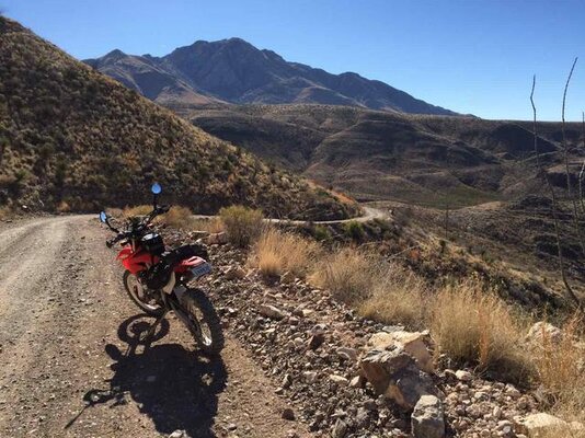
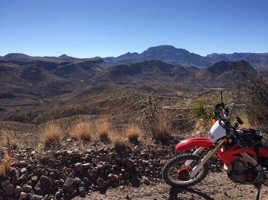
Is this public access or Terlingua Ranch (POATRI) private property.
 
I was looking at property to purchase. Yeah, that’s what I was doing... [emoji3]


Sent from my iPhone using Tapatalk
 
Last edited:
That's a great vid. Is that from the state park or the northern end of the Blue Ridge past the Left Hand Shutup. Haven't been up there for years.
 
Its called "On Top of the World" and I don't have the coordinates. Its in the Big Bend area. East of the State park, north of Terlingua. I need to get the coordinates some day.
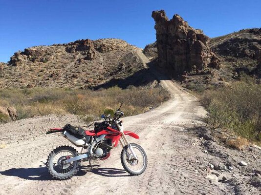
I figured out where it is but have been told it is a bad idea to post it.
that and people shoot at you.
 
Last edited:
I ended up doing some solo riding based out of Presidio on the 29th and 30th. I did Pinto Canyon and Chispa along the river on the 29th (parked my truck in Ruidosa). On the 30th I parked my truck outside of the BBRSP entrance (paid my entrance in Presidio) and rode up to the NW section and did the Casa Piedra loop (thank goodness for a pre-loaded gps track). I've rode the other accessible sections of the BBRSP on a visit last year. I'll try to post a few pics and maps. Let me know if you need the Casa Piedra loop gpx file. The one I was using ended up a little light on points and led to some bushwacking to recover the road. I have a version of the track with my extracurricular bushwacking removed...


Funny thing on the Top of the World posts - I've been within ~4 miles of that place a few times in the past year and didn't realize it was there... Now I know...

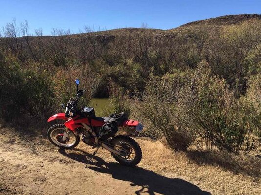
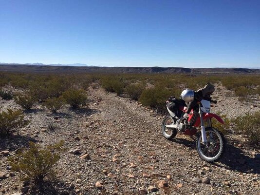
IMG_7642.jpg
IMG_7652.jpg
IMG_7661.jpg
IMG_7662.jpg
IMG_7683.jpg
 
Last edited:
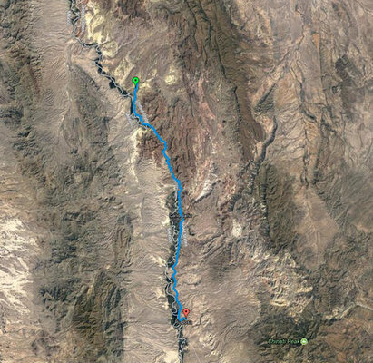
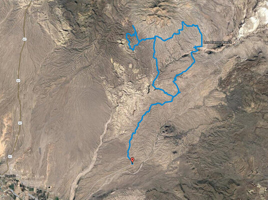
Here are a couple of track images:

Chispa Road (My Pinto Canyon track did not save properly - that is a very scenic road - got up close to a fox, 4 javelinas, and a nice mule deer buck...)
Chispa.jpg

Casa Piedra loop - I didn't see another human in this entire section of the park. Pretty isolated, but a good ride. The worst part was the bushwacking. My 450X does not like to idle around in circles...
CasaPiedra.jpg
 
Last edited:
I ended up doing some solo riding based out of Presidio on the 29th and 30th. I did Pinto Canyon and Chispa along the river on the 29th (parked by truck in Ruidosa). On the 30th I parked my truck outside of the BBRSP entrance (paid my entrance in Presidio) and rode up to the NW section and did the Casa Piedra loop (thank goodness for a pre-loaded gps track). I've rode the other accessible sections of the BBRSP on a visit last year. I'll try to post a few pics and maps. Let me know if you need the Casa Piedra loop gpx file. The one I was using ended up a little light on points and led to some bushwacking to recover the road. I have a version of the track with my extracurricular bushwacking removed...


Funny thing on the Top of the World posts - I've been within ~4 miles of that place a few times in the past year and didn't realize it was there... Now I know...

Pinto Canyon road is nice and big bike friendly. I did it years ago on the 1150 with street tires.

Yes, the "Top of the World" is very close to the eastern boundary of the state park. And the road to it is much easier than anything in the state park, IIRC.

Any waypoints, coordinates, routes or tracks you download or find on the internet should be used at your own risk. Dirt roads can change on a daily basis and there are other hazards out in the desert. Its always best to ride with a group. That way if you fall down, there will be someone to get the photo. :trust:

Nice photos.
 
I'm going to be adding to the video. Send me your still photos and videos if you ok with me using them in the video. Those video files can be given to me at Ice Cream night this week on a thumb drive since they get pretty big pretty quickly.
 
About Chispa - I've heard conflicting reports if you can actually ride all the way from Ruidosa to 90 via Chispa Road (through Candelaria, not through Pinto Canyon). Looks like you went out and back - think you could have kept going? Or did a locked gate or unpassable road stop you?
 
Pinto Canyon road is nice and big bike friendly. I did it years ago on the 1150 with street tires.

Yes, the "Top of the World" is very close to the eastern boundary of the state park. And the road to it is much easier than anything in the state park, IIRC.

Any waypoints, coordinates, routes or tracks you download or find on the internet should be used at your own risk. Dirt roads can change on a daily basis and there are other hazards out in the desert. Its always best to ride with a group. That way if you fall down, there will be someone to get the photo. :trust:

Nice photos.

Agreed - solo is not ideal in places like BBRSP. If I could scare up some riding partners in West Texas, I would be happy to bring them along. I do carry a very complete tool setup and satellite based 2-way comms when I am solo.

I was even closer to the "Top" a few times in the past year in the ranch at the Blue Ridge/Hen Egg corner.

Cool drone footage.
 
About Chispa - I've heard conflicting reports if you can actually ride all the way from Ruidosa to 90 via Chispa Road (through Candelaria, not through Pinto Canyon). Looks like you went out and back - think you could have kept going? Or did a locked gate or unpassable road stop you?

I believe that it can be done, but you are right - I went out and back. I passed through two gates (left them as I found them each way - closed). My interest was the road along the river and I didn't want to do any more pavement time than I had to. No issues with road conditions.

I was a little uneasy being alone on this isolated road. I felt fine as long as I was moving (not much is going to catch a 450X if I needed to bug out), but when I stopped in a lot of tree cover to open/close gates I felt a little venerable. Just playing head games with myself. I was looking for a reason to turn around when I came into view of a pickup and a couple of RVs. Satellite images look like a semi-permanent cowboy camp, but my imagination went straight to Breaking Bad/Meth Lab... If there was a way to link a dirt-road loop from chispa to Pinto I probably would have just flown right through :rider:.
 
ccasey75,

The next time you are out there, you should ride the NW section of the BBRSP. It is REMOTE, but really cool. There is a trail head off of Casa Piedra where you can park a truck/trailer if you like. Gas is an issue for bikes with short range. The nearest gas is Presidio, or the lodge area of the state park if you bright gas with you and have it there. On each end of the ride, you have about 30 miles of riding to/from the trail head in addition to the riding you do on the loop. The loop is a "road", not a trail. I do believe you need to be on a street legal bike.

Pics and info here,
http://www.twtex.com/forums/showthread.php?t=68232

I don't know if I still have the GPS tracks for that section though. I am sure someone around here has them.
 
Back
Top