• Welcome to the Two Wheeled Texans community! Feel free to hang out and lurk as long as you like. However, we would like to encourage you to register so that you can join the community and use the numerous features on the site. After registering, don't forget to post up an introduction!

Riding dirt for a week in Saguache, Colorado

Joined
Feb 18, 2023
Messages
34
Reaction score
48
Location
Houston, TX
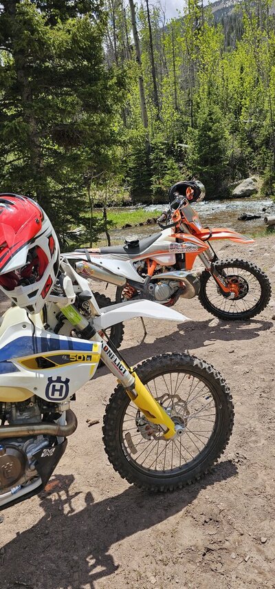
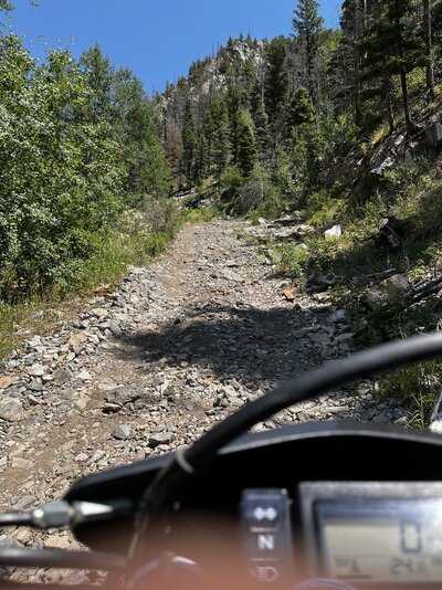
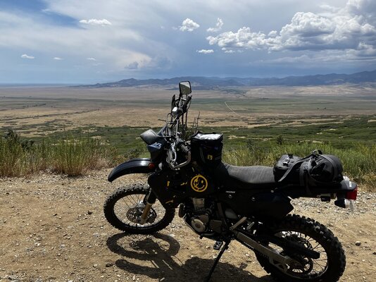
I’m planning on taking my bike up to Saguache, Colorado July 30-August 6. My plan is to get up there, park my truck at a buddy’s place and ride as many park roads, mountain passes, and single track trails as I possibly can. I’m going to be camping off the bike for 1 or 2 nights at a time and then return to Saguache when I need fuel, food, or a medicinal trip to the hot springs. I know I want to ride rainbow trail, entering from Hayden pass and going north. I’d also like to start at the sand dune park and head north on the same trail till I hit Hayden pass and exit the mountain there (mud permitting). Other than that I really just plan on trying new routes each day. I’ve never been up there so I haven’t bothered trying to plan my routes ahead of seeing what the terrain is like.

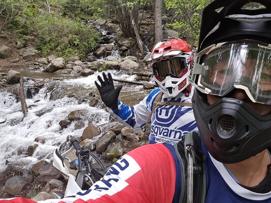
I’ll be riding alone so I thought I’d extend an invitation to join to whoever sees this. I’m excited to trade humid and flat houston for high and dry Colorado for a few days. I’m fine with exploring by myself but I’m open to joining other riders as well.
 
Just came back from doing some od the rainbow trail. Beautiful. Don't go too fast, lots of hikers around. The Alvarado campground is a great place as a headquarters. Close to Westcliff, water, first come first serve sites.
It's a long trail. Figure 6-10 miles covered in an hour. We couldn't do it all.
It's beautiful. Enjoy.


Attachments

  • 20230616_130516.jpg
    20230616_130516.jpg
    276.9 KB · Views: 66
  • 20230616_143433.jpg
    20230616_143433.jpg
    606.3 KB · Views: 65
Just came back from doing some od the rainbow trail. Beautiful. Don't go too fast, lots of hikers around. The Alvarado campground is a great place as a headquarters. Close to Westcliff, water, first come first serve sites.
It's a long trail. Figure 6-10 miles covered in an hour. We couldn't do it all.
It's beautiful. Enjoy.

This is great information, Vinny. I was hoping to avoid most hikers and bikers by riding during the weekdays. How was the mud? I’ve read that this is a pretty rainy season for that area, were there any washed out or impassable areas?
 
Late July-early Aug ought to be just right. I almost drown myself riding Rainbow trail in June one time because of the snowmelt. Make sure you check out the single track up around Sargents- north up to Tomiche Pass, and along Marshal Pass. You might just do the Monarch Crest Trail too. Epic riding up there.
 
This is great information, Vinny. I was hoping to avoid most hikers and bikers by riding during the weekdays. How was the mud? I’ve read that this is a pretty rainy season for that area, were there any washed out or impassable areas?
No mud for us. Some water crossing but none gave us trouble. Rain in the afternoons. Start and end early if you want to be comfortable.
 
You'll have some distance to cover in just about every direction out of Saguache (gas issues). Hitting the rainbow trail at hayden puts you going across the valley and over the mountain (only one "road" through the wilderness) or going north to Salida or south around the dunes. For goodness sake carry a personal locator beacon of some kind. When we talk about hitting single track around Sargents, Rainbow, etc. that's the real deal. Riding solo is really tickling the dragon's tail in a lot of places. Have a means to call in the cavalry at hand. There's almost always riders at Tomichi creek you can join in with. That area is extremely technical riding but at least you'd be with other folks. Closer trails to Saguache are accessible from the rock creek campground areas to the south. Fun and scenic without a lot of life threatening crazy stuff. One trail leads to another all the way up to south fork. Just don't get lost. Have a great trip and keep us posted.
 
You'll have some distance to cover in just about every direction out of Saguache (gas issues). Hitting the rainbow trail at hayden puts you going across the valley and over the mountain (only one "road" through the wilderness) or going north to Salida or south around the dunes. For goodness sake carry a personal locator beacon of some kind. When we talk about hitting single track around Sargents, Rainbow, etc. that's the real deal. Riding solo is really tickling the dragon's tail in a lot of places. Have a means to call in the cavalry at hand. There's almost always riders at Tomichi creek you can join in with. That area is extremely technical riding but at least you'd be with other folks. Closer trails to Saguache are accessible from the rock creek campground areas to the south. Fun and scenic without a lot of life threatening crazy stuff. One trail leads to another all the way up to south fork. Just don't get lost. Have a great trip and keep us posted.
Listen to this man, listen well!! I ride alone 80% of the time here in TX, would never ride alone in CO. My summer is being used up with some surgeries or I would gladly join you. I also think you could find a better spot to camp with more access to amenities.
 
If you haven't already, download the COTREX app for your phone. It's Colorado's Dep of Resources mapping app that is one of the best map/apps you will find in any state. It lets you filter searches for the type of trails, i.e. MC, hiking, mountain biking, jeeping.... ect.
 
You'll have some distance to cover in just about every direction out of Saguache (gas issues). Hitting the rainbow trail at hayden puts you going across the valley and over the mountain (only one "road" through the wilderness) or going north to Salida or south around the dunes. For goodness sake carry a personal locator beacon of some kind. When we talk about hitting single track around Sargents, Rainbow, etc. that's the real deal. Riding solo is really tickling the dragon's tail in a lot of places. Have a means to call in the cavalry at hand. There's almost always riders at Tomichi creek you can join in with. That area is extremely technical riding but at least you'd be with other folks. Closer trails to Saguache are accessible from the rock creek campground areas to the south. Fun and scenic without a lot of life threatening crazy stuff. One trail leads to another all the way up to south fork. Just don't get lost. Have a great trip and keep us posted.
I’m taking a garmin in reach with me. I’ll be sending out my location every half hour or so and I’ve got a friend with a 4x4 who lives near but added onto the contacts. My plan is to start the first few days on wider forest roads to get myself and the bike acclimated to the altitude. It looks like I’ll be dealing with rain so I’ll be playing it by ear and staying closer to my home base in saguache than I had originally planned.
 
If you haven't already, download the COTREX app for your phone. It's Colorado's Dep of Resources mapping app that is one of the best map/apps you will find in any state. It lets you filter searches for the type of trails, i.e. MC, hiking, mountain biking, jeeping.... ect.
Cortex app is a great resource. Thanks for the recommendation.
 
Well It’s finally that time! Been cooped up in a hotel room working in Louisiana for three weeks but now I’m packing the truck and will by in Colorado by tomorrow night. Never found anybody available on my work schedule to ride with so it’ll be a solo affair. I’ll post pictures when I get the chance as well as the link to my garmin in reach track. I’ll be pinging my location every hour for anyone that’s interested. Looking forward to dry air and adventure!
 
First day of riding was a learning experience. The switchbacks on Hayden Pass were a lot steeper than I was ready for. After lots of tractoring and slipping, draining my battery after flooding the bike repeatedly, and a quick roadside charge I turned back around. Downhill on the same section was humbling. The vapor release fitting on the tube of my gas cap came off so each time I laid the bike down gas would shoot out of the cap tube and I got soaked in the spray once while getting my boot out from under the bike.

Took the day off yesterday and now I’m off to look for some more areas where I can spend my time on top of the bike instead of alongside it or under it :^)
 

Attachments

  • BA5B9469-C09D-4C17-ACF3-E42E67280D8A.jpeg
    BA5B9469-C09D-4C17-ACF3-E42E67280D8A.jpeg
    387.6 KB · Views: 60
  • 7990B00C-C035-4B8C-B0C9-538D1F8A2D1D.jpeg
    7990B00C-C035-4B8C-B0C9-538D1F8A2D1D.jpeg
    488.5 KB · Views: 57
Cool. I have been about a hundred miles west of there doing the same thing. The very steep switchbacks take some getting used to. Enjoy!
 
Back
Top