Feel free to hang out and lurk as long as you like. However, we would like to encourage you to
 Simmons1
0
- Joined
- May 29, 2005
- Messages
- 5,815
- Reaction score
- 1,540
- Location
- Out Riding
- First Name
- Rich
- Last Name
- Simmons
*** No Motorcycle content other than a couple photos in a museum part way through the trip***

Linda’s bucket list was down to 3 items. We have been talking about a 3 week 5K ride on our Honda Gold Wing for a few years to knock off a couple of them, along with checking out some other things along the way including more of Route 66. We studied maps asked for some suggestions and planned a basic route.
Our departure date was intended to balance getting out of and back to Texas before it got too hot and when enough of the heavy snow out West would gone. When it came time to leave the West was already getting into an extended hot weather pattern.
As Clint Eastwood famously said, “A man’s got to know his limitations.” So, at the last minute we decided to do the trip in the car instead. I wasn’t so sure at the time, but taking the car was correct move in the end due to the weather.
Day 1 Fort Worth to Joplin, Moriarty, NM
Loaded up and out shortly after sun up. Leon did a Pie Run many years ago to what would be our lunch stop. I missed that Pie Run.


After a great lunch and slice of Green Chile apple pie, also known as New Mexico Apple pie we were back on the road.


Back on the road into New Mexico the car thermometer read 112, and we decided right then that taking the Mazdarati was the right call. If we were on the bike would have called it a day in Tucumcari, in the car we pushed on to Moriarty.
By luck we chose an old Route 66 Hotel that turned out to be a real gem.

I had a very interesting visit with the owner. The hotel has a storied history and regularly gets used in movies. For instance, the Motel scenes in “**** or High Water” were filmed in room 18. Several rooms had stickers like this on the windows.


Immediately next door was another neat old building that looked familiar but took me a bit to remember where I had seen it. For those of you that get Peacock there was a series called “Poker Face”. This building was one of the main filming locations in Episode 2. The hotel owner said the film crew was there for about 7 weeks filming the Episode.


Day 2 Moriarty to Flagstaff, AZ
Since we got a little farther than planned yesterday, we had plenty of time to stop and see a few things.


Linda’s life time National Park Pass saved as a bunch of money at this stop.


And now in the Petrified Forest.


It was getting really hot outside but is still pretty early in the day. He headed to Holbrook for lunch. This slice of Green Chile apple pie we ate a local dinner after lunch was not very good.

I originally had planned to on staying in an old Route 66 Motel in Winslow. Since we were standing on the corner in Winslow, Arizona last time we were out here on the Gold Wing we decided to go on to Flagstaff after checking out a big hole in the ground.

Despite efforts from the government to purchase the crater it is still privately owned. It has a pretty interesting history.
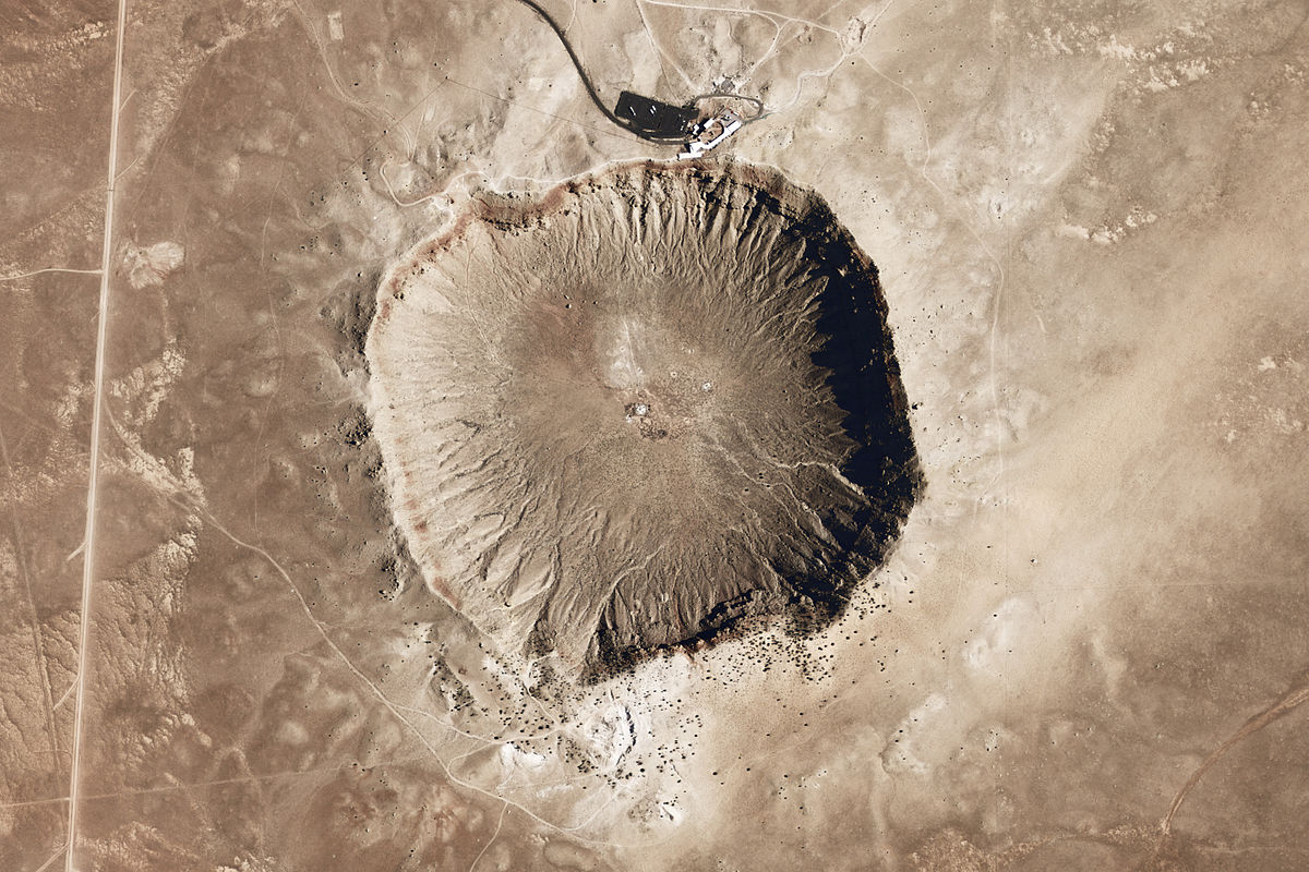
 en.wikipedia.org


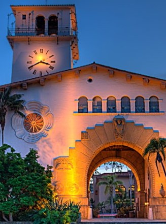
Day 3 Flagstaff to Williams, AZ
Last time we were out this way on the Gold Wing in May of 2019 our visit to the Grand Canyon wasn’t so nice. It was Linda’s first visit to the Grand Canyon and as we arrived at the South entrance a weather front blew in covered the canyon in clouds/fog and snow flurries. This time would be different.
We had been reading horror stories about couple hour long waits at the South Entrance to get in to the park. We decided to eat the hotel breakfast as soon as it started and go in the East entrance which we were hoping would be less busy. It seems like everyone else in the hotel had similar breakfast plan. At 6:30 am the breakfast room looked like feeding frenzy.
We had a nice relaxed traffic free drive to the East entrance. There was no line at all. This worked great as the farther we headed West in the park the busier the overlooks got.


Inside the Watch Tower


By the time we got to the South Entrance it was a sea of people and cars.


After fighting the crowds to snap a few pictures it was South to Williams.

We got lucky with parking on the main drag in Williams and walked across the street for lunch.

While eating lunch we decided to call it a day and not head for Barstow. The good news this old Route 66 Hotel was right in the thick of things. The bad news it was a real dump at $100 a night.

Our walk around Williams.


Day 4 Williams to Barstow, CA
Got on the road and headed towards Barstow where we change direction from West to North. First, we had to get there. Kingman had a couple museums that looked like they might be nice to see.
The Kingman Visitors Center was really nice and worth a stop if you are passing through.
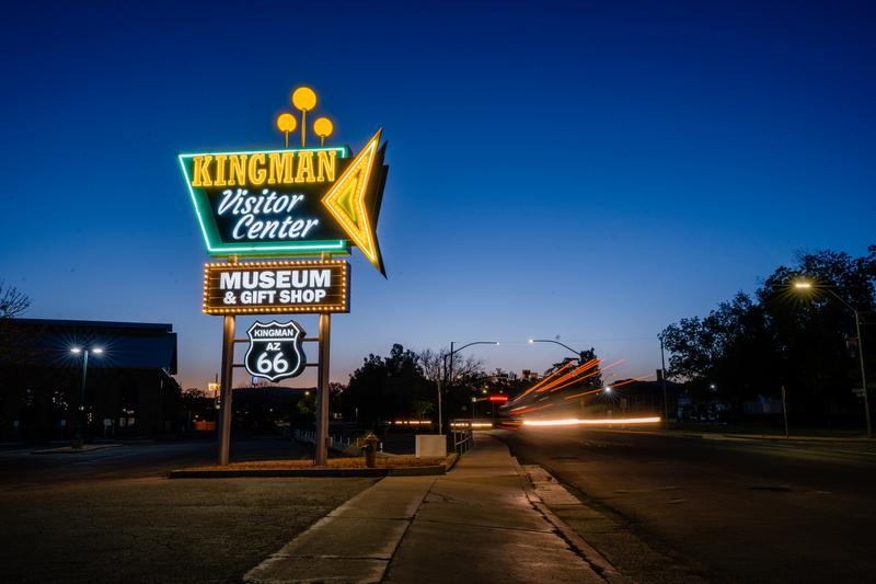
 www.explorekingman.com


Right across the street from the visitor’s center

Before leaving town, we stopped at the Mohave Historical Museum. Very interesting history of the Kingman area.
 www.mohavemuseum.org

They claim to have one of the few museums that has a portrait of every US President on display.


Leaving Kingman we had a choice to make. Stay on I-40 or head to Laughlin, NV. We opted for Laughlin. Leaving Kingman there is along climb on 68. When you get to the top there is long downhill to Laughlin. The outside thermometer in Linda’s car was reading 115 when we crossed the Colorado River and in to Nevada.

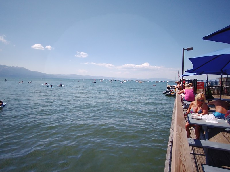
We found a nice shaded place to park and had lunch in a big sports bar before continuing on. We took 95 up to Searchlight, NV and then 164 to I-15. No pictures unfortunately, but route 164 through the Northern part of the Mohave Desert was loaded with Joshua Trees. We had never seen them before. It was pretty neat.
I-15 to Barstow had a lot of traffic. We got off the highway in Barstow on Old Route 66. A lot of the old Motels were either closed or really run down. We wound up staying in a Quality in that turned to be quite nice for us. Had a shaded courtyard and pool, laundry facility and possible the best Hotel Restaurant I have ever eaten in.

Day 5 Barstow tourist day
He hadn’t been checked into the hotel long last night when we decided it was time for a non-driving day. We scoped out a few things to do for the day.
First up was the Barstow Route 66 Museum. Its an older small museum staffed by volunteers. It contained a lot of local memorabilia and history of Route 66 including its hey day during the dust bowl. It was very interesting.


My old boss that now lives outside of Lampasas has a 48 that looks just like this one.

Next up was the Railroad Museum a couple minute walk away. Barstow has a rich railroad history starting back in the 1870’s.
From Wikipedia:
“Barstow Yard is a classification yard operated by Burlington Northern Santa Fe Railway (BNSF) in Barstow, California. With 48 directional tracks and a total area of approximately 600 acres (240 ha), it is the second largest classification yard west of the Rocky Mountains after the JR Davis Yard. Today, almost all freight traffic to and from Southern California runs through the junction.”


From the you learn something new everyday file, we learned about “date nails” which are pounded into cross ties so that the railroad knew the wooden ties were lasting. There was quite a collection of them from all over the world. Sorry about the blurry photos.


Last but not least we checked out the restored Harvey House.


We knew nothing about Harvey Houses, or Harvey girls until now.
From Wikipedia:
“The Fred Harvey Company was the owner of the Harvey House chain of restaurants, hotels and other hospitality industry businesses alongside railroads in the Western United States. It was founded in 1876 by Fred Harvey to cater to the growing number of train passengers. When Harvey died in 1901, his family inherited 45 restaurants and 20 dining cars in 12 states. During World War II, Harvey Houses opened again to serve soldiers as they traveled in troop trains across the U.S.”
“In 1883, Harvey implemented a policy of employing a female, white-only serving staff. He sought single, well-mannered, and educated American ladies, and placed ads in newspapers throughout the East Coast and Midwest for "white, young women, 18–30 years of age, of good character, attractive and intelligent". The girls were paid $18.50 a month, plus room and board, a generous income by the standards of the time.”
Linda has become very interested in the Harvey Girls and has read 3 books about them already.


The last fun thing of the day was going across the street from our Hotel and watching the new Indiana Jones. Flick. Linda had a steak and I had Shrimp Enchiladas in the Hotel restaurant that were to die for.

To be continued...
Linda’s bucket list was down to 3 items. We have been talking about a 3 week 5K ride on our Honda Gold Wing for a few years to knock off a couple of them, along with checking out some other things along the way including more of Route 66. We studied maps asked for some suggestions and planned a basic route.
Our departure date was intended to balance getting out of and back to Texas before it got too hot and when enough of the heavy snow out West would gone. When it came time to leave the West was already getting into an extended hot weather pattern.
As Clint Eastwood famously said, “A man’s got to know his limitations.” So, at the last minute we decided to do the trip in the car instead. I wasn’t so sure at the time, but taking the car was correct move in the end due to the weather.
Day 1 Fort Worth to Joplin, Moriarty, NM
Loaded up and out shortly after sun up. Leon did a Pie Run many years ago to what would be our lunch stop. I missed that Pie Run.
After a great lunch and slice of Green Chile apple pie, also known as New Mexico Apple pie we were back on the road.
Back on the road into New Mexico the car thermometer read 112, and we decided right then that taking the Mazdarati was the right call. If we were on the bike would have called it a day in Tucumcari, in the car we pushed on to Moriarty.
By luck we chose an old Route 66 Hotel that turned out to be a real gem.
I had a very interesting visit with the owner. The hotel has a storied history and regularly gets used in movies. For instance, the Motel scenes in “**** or High Water” were filmed in room 18. Several rooms had stickers like this on the windows.
Bed Fellow
Mike Pogue, who owns and runs Sunset Motel with his wife, Debbie, keeps Route 66 alive with vintage vibes and personal service.
www.newmexicomagazine.org
Immediately next door was another neat old building that looked familiar but took me a bit to remember where I had seen it. For those of you that get Peacock there was a series called “Poker Face”. This building was one of the main filming locations in Episode 2. The hotel owner said the film crew was there for about 7 weeks filming the Episode.
Day 2 Moriarty to Flagstaff, AZ
Since we got a little farther than planned yesterday, we had plenty of time to stop and see a few things.
Linda’s life time National Park Pass saved as a bunch of money at this stop.
And now in the Petrified Forest.
It was getting really hot outside but is still pretty early in the day. He headed to Holbrook for lunch. This slice of Green Chile apple pie we ate a local dinner after lunch was not very good.
I originally had planned to on staying in an old Route 66 Motel in Winslow. Since we were standing on the corner in Winslow, Arizona last time we were out here on the Gold Wing we decided to go on to Flagstaff after checking out a big hole in the ground.
Despite efforts from the government to purchase the crater it is still privately owned. It has a pretty interesting history.
Meteor Crater - Wikipedia
Day 3 Flagstaff to Williams, AZ
Last time we were out this way on the Gold Wing in May of 2019 our visit to the Grand Canyon wasn’t so nice. It was Linda’s first visit to the Grand Canyon and as we arrived at the South entrance a weather front blew in covered the canyon in clouds/fog and snow flurries. This time would be different.
We had been reading horror stories about couple hour long waits at the South Entrance to get in to the park. We decided to eat the hotel breakfast as soon as it started and go in the East entrance which we were hoping would be less busy. It seems like everyone else in the hotel had similar breakfast plan. At 6:30 am the breakfast room looked like feeding frenzy.
We had a nice relaxed traffic free drive to the East entrance. There was no line at all. This worked great as the farther we headed West in the park the busier the overlooks got.
Inside the Watch Tower
By the time we got to the South Entrance it was a sea of people and cars.
After fighting the crowds to snap a few pictures it was South to Williams.
We got lucky with parking on the main drag in Williams and walked across the street for lunch.
While eating lunch we decided to call it a day and not head for Barstow. The good news this old Route 66 Hotel was right in the thick of things. The bad news it was a real dump at $100 a night.
Our walk around Williams.
Day 4 Williams to Barstow, CA
Got on the road and headed towards Barstow where we change direction from West to North. First, we had to get there. Kingman had a couple museums that looked like they might be nice to see.
The Kingman Visitors Center was really nice and worth a stop if you are passing through.
Kingman Office of Tourism
Official Office of Tourism for the City of Kingman, Arizona.
Right across the street from the visitor’s center
Before leaving town, we stopped at the Mohave Historical Museum. Very interesting history of the Kingman area.
Mohave County Historical Society – Mohave Museum
www.mohavemuseum.org
They claim to have one of the few museums that has a portrait of every US President on display.
Leaving Kingman we had a choice to make. Stay on I-40 or head to Laughlin, NV. We opted for Laughlin. Leaving Kingman there is along climb on 68. When you get to the top there is long downhill to Laughlin. The outside thermometer in Linda’s car was reading 115 when we crossed the Colorado River and in to Nevada.
We found a nice shaded place to park and had lunch in a big sports bar before continuing on. We took 95 up to Searchlight, NV and then 164 to I-15. No pictures unfortunately, but route 164 through the Northern part of the Mohave Desert was loaded with Joshua Trees. We had never seen them before. It was pretty neat.
I-15 to Barstow had a lot of traffic. We got off the highway in Barstow on Old Route 66. A lot of the old Motels were either closed or really run down. We wound up staying in a Quality in that turned to be quite nice for us. Had a shaded courtyard and pool, laundry facility and possible the best Hotel Restaurant I have ever eaten in.
Day 5 Barstow tourist day
He hadn’t been checked into the hotel long last night when we decided it was time for a non-driving day. We scoped out a few things to do for the day.
First up was the Barstow Route 66 Museum. Its an older small museum staffed by volunteers. It contained a lot of local memorabilia and history of Route 66 including its hey day during the dust bowl. It was very interesting.
My old boss that now lives outside of Lampasas has a 48 that looks just like this one.
Next up was the Railroad Museum a couple minute walk away. Barstow has a rich railroad history starting back in the 1870’s.
From Wikipedia:
“Barstow Yard is a classification yard operated by Burlington Northern Santa Fe Railway (BNSF) in Barstow, California. With 48 directional tracks and a total area of approximately 600 acres (240 ha), it is the second largest classification yard west of the Rocky Mountains after the JR Davis Yard. Today, almost all freight traffic to and from Southern California runs through the junction.”
From the you learn something new everyday file, we learned about “date nails” which are pounded into cross ties so that the railroad knew the wooden ties were lasting. There was quite a collection of them from all over the world. Sorry about the blurry photos.
Last but not least we checked out the restored Harvey House.
We knew nothing about Harvey Houses, or Harvey girls until now.
From Wikipedia:
“The Fred Harvey Company was the owner of the Harvey House chain of restaurants, hotels and other hospitality industry businesses alongside railroads in the Western United States. It was founded in 1876 by Fred Harvey to cater to the growing number of train passengers. When Harvey died in 1901, his family inherited 45 restaurants and 20 dining cars in 12 states. During World War II, Harvey Houses opened again to serve soldiers as they traveled in troop trains across the U.S.”
“In 1883, Harvey implemented a policy of employing a female, white-only serving staff. He sought single, well-mannered, and educated American ladies, and placed ads in newspapers throughout the East Coast and Midwest for "white, young women, 18–30 years of age, of good character, attractive and intelligent". The girls were paid $18.50 a month, plus room and board, a generous income by the standards of the time.”
Linda has become very interested in the Harvey Girls and has read 3 books about them already.
The last fun thing of the day was going across the street from our Hotel and watching the new Indiana Jones. Flick. Linda had a steak and I had Shrimp Enchiladas in the Hotel restaurant that were to die for.
To be continued...